Post On : December 18, 2017
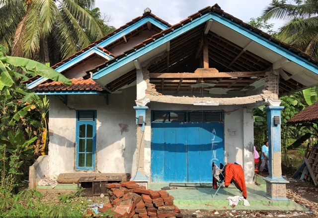
Some time ago precisely on Jumát 15/12/2017, at 23:47:57 WIB there has been a magnitude 6.9 earthquake with the epicenter is located at 11 KM Southwest Tasikmalaya Regency. Based on BMKG data, the earthquake occurred at a depth of 107 KM, resulting in several houses collapsed in Tasikmalaya Selatan, Cikalong and Tibalong sub-districts. This earthquake has the potential of Tsunami in South West Java, Central Java and Yogyakarta. From BMKG monitoring on the same day until 02.14 WIB, there have been three aftershocks with Magnitudes 3.2, 3.4 and 3.2.
This earthquake is also felt in other areas of West Java, Central Java, especially in Bantul, the quake is felt tight 5 -30 seconds and the southern part of Yogyakarta earthquake felt strong or strong 20-30 seconds. Based on a report from BNPB that the current condition, the quake is felt tight for 5-10 seconds in West Java Province, thus making people panic out of the house. Based on its position and depth, the earthquake event is due to the activity of subduction zones formed by the collision or subduction of the Indo-Australian Plate against the Eurasian Plate in southern Java.
Related to this, MAIPARK conducted a survey for 3 days, 21-23 / 12/2017 in Tasikmalaya, Ciamis and Pangandaran. The purpose of the survey to add information in the field of data damage to the earthquake as well as for the purposes of risk analysis Catastrophe MAIPARK. In conducting a survey on the earthquake there are several criteria that become its reference such as earthquake M>7 and at depth 100 heavily damaged houses or other catastrophic events that are important in Catastrophe Risk Analysis.


